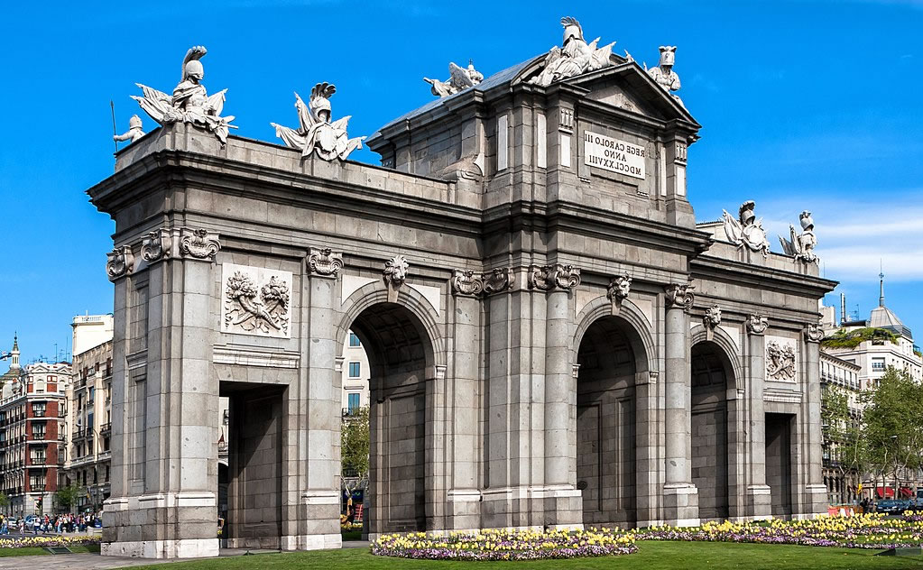
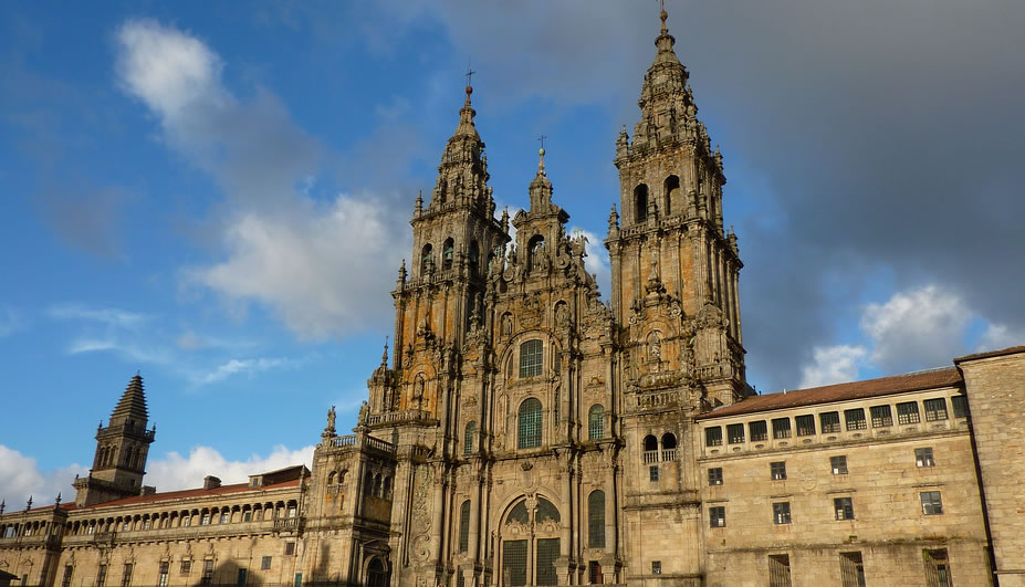
KSO = keep straight on ; LH = turn to left ; RH = turn to right
ALICANTE --- ALBACETE.
Stage One : ALICANTE – NOVELDA. 32,400 m
ALICANTE ---- MONFORTE DEL CID. 28.400m
- ASPHALT. 0 m. Inner-city directions: Start from Basilica de Santa Maria by the sacristy , near the one metre diameter white marble’concha’; go up the stairs (‘los Peregrinos’), KSO along Calle Villavieja, KSO past Plaza de la Santa Faz, passing the back of the ayuntamiento, KSO along Calle Mayor, cross la Rambla and the Portal de Elche, KSO along Calle San Francisco KSO along Avenida de Maisonnave, KSO along Avenida de Aguilera, KSO along Avenida de Orihuela, cross Gran Vía at the roundabout of Músico Emilio Álvarez, KSO again along Avenida de Orihuela to the roundabout of Plaza de la Luna, RH into Vial de los Cipreses, KSO to the cemetery.
- 4 560 m. Plaza la Luna : RH in to Camino de los Cipreses. Cemetery.
- 5 000 m. Plaza del Cementerio, LH into Camino de la Alcoraya, cross under motorway.
- 6 550 m. Crossroads, LH towards urbanizacion La Serreta.
- 7 620 m. Crossroads, KSO (road to left goes to La Serreta).
5.a
- 8 170 m. Track between hillocks, KSO a short distance then LH along small road to culvert.
- 8 740 m. On reaching the road, LH.
- 8 960 m. Crossroads, RH towards quarries.
- Dirt track. 10 300 m. Once past the Sierra de Fontcalent, RH , dirt track.
- 11 500 m. Fork, track to right heads up to rubbish dump, LH.
- 12 400 m. Fork; after house near hill-top, LH.
- 13 300 m. Crossroads, RH.
- ASPHALT. 14 000 m. Road from Rebolledo - La Alcoraya, RH.
- 14 200 m. LH on to asphalt road.
- 14 400 m. Road from left. RH.
- Dirt track. 14 500 m. RH. If you KSO (the road from Rebolledo), you’ll see an ermita (= hermitage) ahead (camino de La Iglesia).
- 14 900 m. Crossroads. KSO.
- 15 000 m. Road from left. RH.
- 15 000 m. Leave the road and LH at the curve on to the path.
- 16 000 m. Fork, LH.
- 16 000 m. Crossroads, LH, along a path.
- 17 300 m. You reach the road to La Alcoraya, KSO.
- 17 500 m. Fork, LH and cross motorway by bridge.
- 18 000 m. Fork, LH. Take the major road.
- 18 300 m. Fork, LH, and KSO.
- 18 400 m. Fork, LH.
- 18 700 m. Care ! Yellow flecha on sign “Coto privado de caza” suggests you should RH, DO NOT FOLLOW; instead, LH then immediately RH; yellow flechas take us to a gully; KSO past terraces of olive trees, then down the slope on the right in to the gully; watch your step.
- 19 000 m. From the bottom of the gully, climb up to the terraces of almond trees; after about 160 paces RH along a track to a road.
- 19 200 m. Road. RH.
- 19 500 m. Fork; the turn to the right is an alternative road to the Cueva de San Pascual, but takes 3 x as long. LH uphill (the old road from La Alcoraya to the Cueva de San Pascual).
- 19 900 m. You reach a small gully. It’s 1 Km from here to the road leading up to the Cueva.
- 20 500 m. T junction, RH 100 metres to a second T junction; about 150 m further on, you can scramble through the pinetrees up to the road that follows the 254m contour line or stay on the road for a further 300 m to reach the same point.
- 21 000 m. T junction on the 254m contour line road. After 100m on the left there is a shortcut up to the Cruz de Orito, up a steep slope along a track beneath the Cruz (near a twin pine tree). The alternative is easier : continue on the road, LH up to the small road that leads up to the Cruz de Orito and then to the Cueva de San Pascual.
- ASPHALT. 21 500 m. T junction. RH up asphalt road to Cueva.
- 21 700 m. On your right , the CRUZ DE ORITO, the first symbolic waymark of the Camino de Alicante. Fuente (drinking water) and tables, picnic spot for the Camino de Santiago.
- Dirt track. 22 100 m. Reach the Cueva de San Pascual. Go down via a steep slope to the left of the chapel (where votive candles are burned – this being the footpath to Orito) until a small road. Cyclists : take the road back to the first T junction and RH until you meet up with the path coming down from the Cueva. Look for the eight 8 line poems on the wall at the side of the road.
- ASPHALT. 22 900 m. Cross the tarmac road. RH and KSO to the poems in the wall, which narrate the life story of San Pascual.
- 23 100 m. Fork, LH.
- 24 400 m. Reach the Camino de la Cueva; cross the road , which comes from the motorway, KSO past Plaza de la Feria
- 24 300 m. KSO past Plaza de la Iglesia, a pine-lined walkway in front of the Sanctuary of Nuestra Señora de Orito and San Pascual Bailón. LH down steps in front of you to the Avenida de San Pascual Bailón.
- 24 900 m. Reach the Ermita de la Aparición, KSO.
- 27 100 m. Cross motorway via subway, and KSO with cemetery and football field to your right. City centre directions : KSO along Avenida de los Pinos.
- 27 700 m. Roundabout : KSO (L) to Calle Agost, Centro de Salud ,LH to Mercado de Abastos, RH to Calle de los Reyes Católicos (near the Mercado,there is a public telephone). Cross the Avenida de Alicante, pharmacy. KSO along Calle Casto Richart; RH second on right .
- 28 400 m. Plaza de España, Ayuntamiento of Monforte del Cid (to your left, steps to the church where Don Jorge Juan et Santacilia was baptised). RH into Calle La Iglesia. LH into Calle Ramón y Cajal, RH into the Plaza del Parador and LH into Calle Jorge Juan, KSO to exit Monforte. Cyclists : at the roundabout, KSO along Avenida Constitución,KSO to Plaza del Parador and RH into Calle Jorge Juan.
MONFORTE DEL CID --- NOVELDA, 4 000 m
0 m. Ayuntamiento of Monforte del Cid.
- 900 m.. Roundabout – LH onto asphalt road to Novelda.
- 1 900 m. Roundabout, take the 4th exit and after 50m KSO on bike path. (On your right, road to Hacienda El Fondonet, birthplace of Don Jorge Juan et Santacilia and city limit of Novelda).
46.a 2 200m. Before new bridge crossing over river, leave bike path and RH in to last street.
46 b. 2 400m Once past 1st street on right, KSO 50m, then LH on to path.
- 3 000 m. LH and cross the river by the combined bridge and roundabout. To your left, near the football pitch : local police and Civil Defence. Inner-city directions : KSO , leaving football pitch to your left. Cross at traffic lights; in front, 24 hour petrol station w/telephone; KSO along Calle Sargento Navarro (albergue de peregrinos at no. 31 –NB : call the night before Paco Serra, 629.66.88.29 ou 965.60.08.42.); (cyclists : at the lights , RH towards Castillo de la Mola;) KSO along Calle Travessía.RH into Calle Jose Luis Gómez Navarro and
- 4 000 m. Plaça Vella, Ayuntamiento of Novelda and Iglesia de San Pedro Apóstol (in the centre of the Plaza : bronze statue of Jorge Juan). KSO along Calle Mayor. (Paco Serra’s office is at no. 14 : he stamps “credenciales” and has the keys to the albergue.) KSO along Calle Víctor Pradera, KSO past Plaza de Santa Maria Magdalena, KSO along Paseo de los Molinos.
End of Stage One : ALICANTE – NOVELDA.
=====================================
Stage Two : NOVELDA – VILLENA. 34 900 m
NOVELDA --- ELDA. 12 900 m
ASPHALT. 0 m. Plaça Vella ,police station, ayuntamiento of Novelda, church of San Pedro Apóstol (in the centre of the Plaza : bronze statue of Jorge Juan). KSO along Calle Mayor. (Paco Serra’s office is at no. 14; he stamps ‘credenciales’ and has the keys to the albergue.) KSO along Calle Víctor Pradera,KSO past Plaza de Santa Maria Magdalena, KSO along Paseo de los Molinos.
- 398 m. Start of the PR-V 133 path; at Plaza de Santa Maria Magdalena, KSO along Paseo de los Molinos to the slope leading to the first mill.
- Dirt track. 1 000 m. RH on to the dirt track, leaving the road.
- 1 410 m. Cross the Vinalopó stream via the small bridge, then LH on to 2m wide walkway in river-bed.
-
- 1 860 m. On the right : Finca Sicilia (good wine). KSO following the stream.
- 2 840 m. Cross the clay-sided irrigation canal and KSO , passing by the ruined buildings and debris of the first marble quarry in Novelda, established by Paco Serra’s great-grandfather.
- 3 500 m. 20-column aqueduct ; pass under the first column on the left and KSO.
- 3 720 m. Fork; (the turn to the left goes to the Santuario de Santa Maria Magdalena. To visit this : follow the PR V-113 path; after 100m, road to right, LH up Acequia Mayor, then take the track that rises steeply towards the Santuario and the Castillo with triangular keep). Otherwise, KSO veering to right, cross river and LH.
- 4 620 m. Fork, KSO; saltwater stream from Salinetes approaches from the right.
- 5 090 m. On your left, in the middle of the river-bed, the "Cot Roig", a mineral-rich spring where bathers emerging from the waters are ‘bleached’ by the salts; 200 m upstream is the "Clot Negre" with sulphurous water. KSO.
- 5 300 m. Fork, KSO . Care ! don’t take the path to the right going uphill.
- 6 010 m. Fork. Turning to the left goes to Monovar, KSO. Watch out for the AVE construction work.
- 7 120 m. Cross under the Pont de La Jaud, a blue-painted metal bridge carrying the railway track.
- 7 220 m. On your left, the ruins of the La Jaud water mill. KSO.
- 7 450 m. Fork. LH, cross the stream and RH along the river on the other side.
- 8 370 m. Finca Lacy industrial park, KSO parallel to the left bank of the stream. Fork after 150 m.; right turn recrosses the stream, KSO (L).
- 9 210 m. Reach the road. Cross under it and KSO parallel to the stream.
- 9 640 m. Metal bridge and pipeworks of water treatment plant. KSO. Use the bridge if there’s a lot of water in the stream.
- 9 820 m. Cross the stream (use stepping stones if needed), if the water’s too deep, cross upstream. LH taking the path up the right bank of the stream.
- 11 200 m. As the path comes to an end , head down towards the river-bed and follow the track. Alternatively, take the road to the right , following the yellow flechas that lead to the municipality warehouse.
- 11 700 m. You reach the fencing of the Elda municipality warehouse. KSO along this fencing to the start of the waterworks.
- 12 000 m. Cross the metal footbridge passing over the waterworks. RH and pass below the Centro Excursionista Eldense bridge ; KSO through park.
- 12 400 m. Care ! at the end of the first lagoon, RH and cross the stream via the walkway, then continue up the right bank until near the stone bridge, where you take the path to the right that heads up to calle Circunvalación (= ring-road). If you KSO along river-bank, that takes an extra 2 Km, although you would pass by the old Elda dam.
- ASPHALT. 12 900 m. Inner-city directions: At traffic lights, KSO along calle Novo Hamburgo and, once level with the castle, RH to plaza and ermita of San Anton, KSO along calle Independencia, LH in to calle Purisima, RH past Plaza de la Constitucion (Ayuntamiento of Elda), KSO to Plaza del Sagrado Corazon, KSO along calle San Francisco (Palacio de Justicia and church of Santa Ana), LH in to calle Luis Bunuel then , at the roundabout, LH in to Avenida Nuevo Hamburgo up to the bridge and RH in to Avenida Sax; take tunnel under railway tracks, KSO along the road to Sax , at roundabout before hospital , RH in to calle Malva.
ELDA --- PETRER
72a. ASPHALT. 12 900m. Inner-city directions : At traffic-lights, KSO along Calle Novo Hamburgo and, once level with castle, RH to plaza and ermita of San Anton, KSO along Calle Independencia, LH in to Calle Purisima, RH past Plaza de la Constitucion (Ayuntamiento of Elda), KSO to Plaza del Sagrado Corazon, KSO along Calle San Francisco (Palacio de Justicia and church of Santa Ana), KSO on calle Pedrito Rico, RH in to calle Reyes Catolicos, LH and go diagonally across Plaza de Castelar, RH in to Joaquin Coronel, LH in to Avda. Jose Martinez Anido (aka Gran Avenida), KSO and cross roundabout of Avenida de Madrid (bus station), KSO along Avenida Reina Sofia, KSO and cross roundabout Parque 9 de Octubre, LH in to calle Damaso Navarro, LH in to avenida de Salinetas, KSO along Paseo de la Explanada, KSO in to calle Jose Perseguer, RH in to calle Canovas del Castillo, KSO to plaza del Decrrocat (Ayuntamiento of Petrer), LH in to calle Constitucion, RH in to calle Sancho Tello, LH in to calle La Huerta, RH in to calle Salida del Guirney, KSO along Avenida del Guirney to Petrer roundabout; leave the Carrefour Vinalopo shopping complex to your right and cross under motorway by tunnel, then KSO in the direction of ‘Los Olivos’ restaurant…..
ELDA --- SAX, 8 400 m
0 m. Ayuntamiento of Elda . Inner-city directions : Plaza de la Constitucion (Ayuntamiento of Elda), KSO to Plaza del Sagrado Corazon, KSO along calle San Francisco (Palacio de Justicia and church of Santa Ana), LH in to calle Luis Bunuel then , at the roundabout, LH in to Avenida Nuevo Hamburgo up to the bridge and RH in to Avenida Sax; take tunnel under railway tracks, KSO along the road to Sax , at roundabout before hospital , RH in to calle Malva.
- 2 600 m. You reach the road to la Torreta (Sax); either RH on the asphalt road (recommended for cyclists), or LH, head downhill 100m and RH on to the road.
- 2 700 m. RH, climb 3 terraces to the road, then RH and follow the road to the pass of la Torreta.
- 3 000 m. You reach the pass, on the Elda-Sax road; cross and RH along road, follow for 20m and LH along path alongside fencing. Cyclists should stay on the road.
- 3 300 m. Crossing; the turning to the left goes to the road, KSO.
- 3 400 m. Fork. Road to left, KSO®.
- 3 700 m. Cross the asphalt road.
- 3 800 m. Road to right, KSO.
- 3 900 m. T junction, RH (If you take the LH, you come out on the old road that skirts the present one; you follow for some 300m, continue a further 300m along an unmade-up road, then RH on a path past livestock pens leading to the riverworks.
- 4 100 m. RH and then LH on village outskirts, leaving the livestock pens to your left and the stream to your right..
- 4 600 m. Reach the new waterworks and continue on the left hand side.
- 6 000 m. Cross the stream at the car crossing and LH.
- 7,700 ASPHALT. m. End of path. LH, cross stream via bridge.
- 7 900 m. Inner-city directions : Go over roundabout (Cruz Roja = Red Cross on your left), follow route marked out with tiles with ‘conchas’ KSO along Calle San Sebastián (cyclists : RH in to Calle Canalejas),RH in to Gran Vía, KSO to Plaza Cervantes, KSO along c/ Médico Cortés.
- 8 300 m. Plaza de España, church and ayuntamiento of Sax, tile “a Santiago 1000 km”. KSO along Calle Mayor,KSO along c/Remigio Soler, KSO along Avenida Jaime I.
SAX --- VILLENA, 13 600 m
0 m. Ayuntamiento of Sax.
- 400 m. Below the castle cliff, LH up the road.
- 500 m. RH towards Colonia de Santa Eulalia.
- 5 000 m. Dirt track . You reach the main square in Colonia de Santa Eulalia, KSO following the road.
- 5 700 m. Fork. Go over a small bridge and LH. At the next fork, LH . (If you RH, you go to the small road mentioned below).
- 6 600 m. Reach a small road. Cross it and KSO.
- 7 000 m. Cross the stream via the medieval stone ford. KSO to the next road and RH towards the pine-grove.
- 8 200 m. Pass pine-grove and house on your right, then LH.
- 8 300 m. Fork. RH, leaving drain to your left.
- 10 200 m. T junction, asphalt road, RH.
- 10 800 m. Cross railway track , carefully ! KSO.
- 11 600 m. Cross the drain via the small bridge, KSO.
- 12 900 m. City centre directions : You come in on Camino de la Rajá, past Colegio Ruperto Chapí and traffic lights. KSO along Calle San Benito,RH to El Hilo, KSO past Iglesia de Santa María,KSO toPlaza Mayor, KSO along Calle Teniente Hernández Menor,
- 000
- 13 600 m. Plaza de Santiago, ayuntamiento of Villena, parish of Santiago.
End of Stage Two : NOVELDA – VILLENA.
======================================
Stage Three : VILLENA – YECLA, 23 800 km
0 m. Plaza de Santiago, ayuntamiento of Villena and parish of Santiago, KSO along Calle Ramón y Cajal, KSO through the Puerta de Almansa, KSO along Avenida de la Constitución.
- 368 m. LH at church of María Auxiliadora, KSO along Calle La Virgen, KSO on the road towards Yecla, LH on the road to Pinoso.
- 1 260 m. Dirt track. Leave road and RH on the Vial Ecológico (green path). We follow this former railway track Villena – Cieza, as far as Yecla.
- 2 550 m. Cross the road; 200 m. on the right, hermitage of San Bartolomé and fuente.
- 5 970 m. Casa del Procurador; fork in the road parallel to ours; the left fork goes to Pinoso, the right fork to the Sanctuary of the Virgen de las Virtudes (patron saint of Villena). (At the end of the Vial Ecológico, RH if you want to detour to the Sanctuary; you rejoin the Camino by following a path from the Sanctuary to the Casa del Patronato, leading to a small ruined house. If you don’t want the detour, KSO, leaving to your left a round house before reaching the small roofless ruined house.(This was the Las Virtudes railway station. The way back from the Sanctuary links up with us here); cross a small walkway with rail track markings in the stonework and KSO.
- 10 200 m. Crossing with Las Moratillas road and small roofless station house. KSO.
- 11 000 m. Pine trees on both sides of road and high tension cable, which we follow for a while. KSO.
- 11 800 m. New, white-painted house partly on railway track. Pass by to right and KSO.
- 14 100 m. Crossing. KSO.
- 14 800 m. Cross a walkway, stones of railway bridge can be seen. KSO.
- 17 400 m. Cross a road from left. Weekend villas, then the railway track practically runs out. KSO.
- 18 300 m. Road to left. KSO, passing behind factories in the business park on our right.
- 19 800 m. Crossing, KSO, following the road and high-tension cables towards Yecla.
- 20 000 m. Crossing, KSO.
- 20 600 m. ASPHALT. m. You reach the point where the Yecla-Villena road meets the Excalextric road. KSO on the left side of the road.
- 21 900 m. Ruins of an old stone railway bridge to your left.
- 22 300 m. Roundabout. Inner city directions : petrol station with shop, KSO. Park and lake on the right.
- 22 600 m. T junction. LH goes to Jumilla; RH into Avenida de Literato Azorín, KSO along Calle Camino Real, KSO past Parque de la Constitución, LH in to c/ Miguel Golf, KSO along c/Murillo.
- 23 800 m. Plaza Mayor, ayuntamiento of Yecla.
End of Stage Three : VILLENA – YECLA.
=======================================
Stage Four : YECLA – MONTEALEGRE DEL CASTILLO, 30 400 m
0 m. ASPHALT. Plaza Mayor, ayuntamiento of Yecla (cyclists :take c/Epifanio Ibáñez, RH in to c/ Carlos III, RH in to c/ Francisco Azorín, LH in to Avenida de Córdoba). Plaza Mayor, KSO along c/ Corbalán, KSO past Plaza de la Purísima, KSO past Plaza de España, KSO past c/San Francisco, KSO past Parque de la Constitución, LH in to Calle del Carmen, KSO along Calle San Luis, RH in to Avenida de Córdoba.
- 560 m. Avenida de Córdoba, Colegio La Paz, KSO on the road to Almansa, roundabout, LH towards Fuente Álamo – Jumilla, KSO along c/ Cayetano de Mergelina , then
- 1 100 m. at traffic lights, RH on asphalt road. 200 m. further on lies the small hermitage of San Isidro.
- 1 640 m. Fork, LH.
- 2 310 m. X-shaped crossroads, LH.
- 2 810 m. Fork, RH.
- 3 080 m. X-shaped crossroads, LH.
- 3 230 m. Dirt track. Fork, RH.
- 3 460 m. Road heads off right, KSO.
- 3 720 m. Fork, RH between olive trees.
- 3 810 m. ASPHALT. X-shaped crossing, LH.
- 4 040 m. Dirt track. 100 m. after a Z-shaped (=staggered) crossing.
- 4 480 m. ASPHALT. Road to right , KSO.
- 4 700 m. Fork. LH, houses to left and right.
- 4 700m. Dirt track. 20m from road, continue parallel to it.
- 6 000m. Dirt track. Leave road, RH on to cattle track.
134. 6 150 m. Road to left , following fencing of a villa. KSO.
135. 6 870 m. Crossroads, KSO.
136. 7 490 m. Fork, start of long fence to our right. KSO.
137. 7 800 m. One path heads off to right, then another to left. KSO.
138. 8 150 m. Cross a gully, KSO.
139. 9 910 m. Path off to the left, KSO in a former clay-pit.
140. 10 100 m. Path from left, KSO.
141. 10 800 m. Path on left, KSO.
142. 10 900 m. Path on left, KSO.
143. 12 600 m Path heads off to left, KSO.
144. 13100 m. Alto del Pulpillo, KSO.
145 13 500 m. Link up with path coming from right, LH.
146 14 200 m. RH on path near agricultural building. (Ahead and to left are the first houses of Pulpillo, near the road.)
147. 14 400 m. Path, LH.
148. 17 800 m Diagonal crossroads, KSO.
149 17 850 m. Join path coming from left. RH., passing to right of Casa de los Hitos. 100m. further on, LH by new industrial building.
150. ASPHALT. 18 600 m. Road from left, RH.
151. Dirt track.19 000 m. Casas de Almansa, cross road and RH on path parallel to and left of road.
152 20 900 m. Crossroads, left to Cerro de los Santos, RH on to asphalt road.
153. 21 100 m. Leave asphalt road and LH on dirt track near hut.
154 21 300 m. Fork near electricity pylon, LH.
155 21 800 m. Fork, LH.
156 22 200 m. Fork, LH..
157 22 400 m. T junction, RH.
158 23 000 m. Fork, RH.
159 23 200 m. Path from right, LH.
160 23 300 m. Fork, LH.
161 23 900 m. Care ! 250 m before this point, the path is blocked by a rabbit-proof fence. Be sure to leave it as you found it, so that walkers will not be denied use of this route in future. One path heads to the left, then another to the right. Ignore both and KSO, veering to the right.
162 24 300 m. Crossroads, path from right and another from left, KSO.
163 24 400 m. Fork, left to houses, RH.
164 24 600 m. Fork, LH.
165 25 000 m. Link up with wide path. RH.
166 25,300 m. Crossroads, KSO.
167 25 600 m. Reach a rise, with view of path all the way to Montealegre del Castillo, KSO.
168 25 900 m. Crossroad, KSO.
169 27 200m. Path heads left, KSO.
170 ASPHALT. 27 600 m. KSO.
171 28 200 m. Fork, RH.
172 29 600 m. Fork; left to villas, RH.
173 30 000 m. 3-way fork, right turn heads up towards castle. KSO to first houses of Montealegre.
174 30 400 m. Ayuntamiento of Montealegre del Castillo, with church of Santiago el Mayor.
End of Stage Four : YECLA – MONTEALEGRE DEL CASTILLO
=========================================
Stage Five : MONTEALEGRE DEL CASTILLO – PÉTROLA, 23 700 m
ASPHALT. 0 m. Inner-city directions : From Ayuntamiento of Montealegre del Castillo and church of Santiago el Mayor, head down Avenida del Generalísimo and cross road.
175 526 m. Petrol station at crossing with Almansa – Hellín road ; keep on road to La Higuera.
176 7 180 m. Public wash-house at La Higuera with ‘concha’. Continue on road towards Corral Rubio. At crossroads, fuente with good water.
177 Dirt track. 7 410 m. White-painted water cistern; LH on wide path.
178 7 670 m. Path to left, KSO.
179 11 600 m. New houses, RH, leaving houses to left.
180 11 700 m. Y-shaped fork, RH.
181 13 500 m. Houses of Puerto, pass by, then RH.
182 15 000 m. Crossroads with windmills; KSO veering to left.
183 15 100 m. Path from right.
184 16 000 m. T junction, RH on to a track running straight for 6 500 m.
185 16 900 m. On the left, path to farm, KSO.
186 ASPHALT. 22 500 m. Cross road from Las Anorias – Corral Rubio.
187 23 100 m. Leave road and LH on to path.
188 23 600 m. Fork, RH towards first houses of Pétrola. Inner-city directions : Calle San Bernabé. ‘Concha’. Fuente with pond, LH in to Avenida Constitución, KSO along calle del Cerro, KSO to church.
189 23.700 m. Albergue next to church, in parish hall (behind ayuntamiento of Petrola)
End of Stage Five : MONTEALEGRE DEL CASTILLO – PÉTROLA.
=======================================
Stage Six : PÉTROLA – ALBACETE, 33,200 m
ASPHALT. 0 m. Albergue next to church, in parish hall (behind ayuntamiento of Petrola), KSO along Calle Nueva.
190 375 m. Last houses in Pétrola.
191 Dirt track. 735 m. Cross road and KSO.
192 2 500 m. Path to left. KSO.
193 3 560 m. Fork, road to La Galana. LH, between houses.
194 4 930 m. Crossroad, RH, leaving Horna to the left. Care ! At the last houses in Horna, a small road heads off right. KSO on dirt track : not easy to see, but runs between this road and the houses.
195 8 250 m. Meet path coming from right. Farm to right. Path from right. Another path on the right. LH.
196 9 680 m. RH and take path running alongside road, between the holm-oaks.
197 ASPHALT. 11 600 m. Crossroads to Casa Gualda, continue on road 500 m ahead.
198 Dirt track. 13 500 m. LH, on path to the left of the road with fork. (RH takes us to Chinchilla , see description at end of this section). KSO to bypass Chinchilla.
199 14 400 m. Crossroads, KSO.
200 15 100 m. Cross over former railway track and LH.
201 15.500 m. Crossroads, RH.
202 15.700 m. Cross railway track using tunnel and LH.
203 16.700 m. Once past the electricity substation, cross railway track using bridge. RH on to path running parallel to and on left of railway track.
204 20.100 m. Crossroads with Pozo - La Leña road, KSO.(Alternatively, RH to caserio with fuente and large tree. LH for bridge mentioned in no.205 below, KSO from fuente to go to Chinchilla).
205 23 100 m. Reach bridge over railway track. Do not cross, instead continue on path, which gradually heads away from the track.
206 23 400 m. Fork, Cansa Lobos property to your left, RH.
207 23 900 m. Crossroads, Cansa Lobos to your left, from the rise you see the path heading direct towards Albacete, KSO.
208 25 200 m. Crossroads, KSO..
209 25 700 m. Crossroads, KSO.
210 26 100 m. Path from right.
211 27 000 m. Path to left, KSO.
212 29 500 m. Path from right.
213 30 000 m. T junction, LH.
214 ASPHALT. 30 300 m. RH, cross road via bridge.
215 31 000 m. Parador Nacional of La Mancha (hotel).
216 31 850 m. Main entrance to Parador. Stay on road, LH.
217 Dirt track. 32 200 m. Leave road, RH on dirt path.
218 32 300 m. Crossroads with cypress trees, KSO.
219 32 600 m. Path to left, KSO.
220 33 200 m. Crossroads, start of housing estate of Facultad de Medicina de Albacete. Inner-city directions : RH in to Avda de la Mancha, at roundabout LH in to Avda del Doctor Arturo Cortes, KSO along calle Carretera de Valencia, KSO past Puerta de Valencia, KSO along calle Santa Quiteria, KSO along calle San Agustin, KSO along calle Martinez Villena, RH in to Plaza de la Catedral and Ayuntamiento of Albacete.
220.a 36 000m Ayuntamiento of Albacete.
Alternative via CHINCHILLA DE MONTE-ARAGÓN 21,000m.
- (Same as no.198 above) Dirt track. 13 500 m. LH, path to left of road. At fork, RH. This is the path that goes to Chinchilla.
- 14 250 m. Crossroads, LH takes you back to the Albacete path, right turn goes to the road, KSO.
- 15 050 m. Cross railway tracks via square-sided tunnel.
- 15 240 m. Cross more railway tracks via second square tunnel. On coming to the next set of tracks, follow alongside for a bit, before RH and passing underneath them.
- ASPHALT. 16 310 m. Former station of Chinchilla, cross over tracks using the road at marker for Km 197.1
- 17 010 m. Stop sign. Cross under motorway and KSO.
- 17 160 m. LH towards Sierra Comunal.
- Dirt track. 17 260 m. Slip-road to left will also take you to Chinchilla, but it’s better to RH on to path heading towards the drill-ground (Campo de Maniobras).
- 17 660 m. Crossroads, LH towards houses.
- 17 880 m. Farmyard buildings to right, KSO.
- 19 540 m. Join slip road.
- 20 030 m. Take path on left that comes from Sierra Comunal.
- 20 200 m. ASPHALT. Stop sign. We have reached the old ‘carretera nacional’. Head up into Chinchilla.
- 20 610 m. Inner-city directions : first houses of Chinchilla, KSO along Avenida de la Guardia Civil, KSO along Calle del Arenal, LH in to Calle Virgen de las Nieves , RH (still on Calle Virgen de las Nieves), KSO to Plaza de la Mancha; ayuntamiento of Chinchilla de Monte-Aragón and church of Santa María del Salvador.
- 21 000 m Ayuntamiento of Chinchilla de Monte-Aragón and church of Santa María del Salvador.
CHINCHILLA de MONTEARAGON --- ALBACETE
- 0 m. Ayuntamiento de Chinchilla de Monte Aragon. Inner-city directions : From Plaza de la Mancha, KSO along calle Virgen de las Nieves, RH along calle San Jose.
- 620 m. Hermitage of San Antonio Abad.
- 1400 m. Cross motorway by bridge and KSO.
- Dirt track. 2,830 m. crossroads, KSO.
- 3 470 m. cross old railway tracks at bridge, KSO.
- 4 040 m. cross new railway tracks and RH.
- 4 530 m. pass excavations for Roman bridge, at fork, RH (left to go to Cansa Lobos)
- 5 030 m. Crossroads. To your left, Cansa Lobos. From the rise you can see the path going straight to Albacete.
- 6 340 m. Crossroads, KSO.
- 6 770 m. Pathway is blocked by earth-mounds. Go round them on the right hand side.
- 7 370 m. Rejoin a straight path, the old Roman road. RH.
- 8 340 m. Path heads off left, KSO.
- 10 800 m. Path joins from left, KSO.
- 11 300 m. End of Roman road, LH towards house, then cross motorway by bridge.
- ASPHALT. 12 100 m. Parador Nacional de la Mancha, KSO veering to left.
- Dirt track. 12 300 m. Leave road, RH on dirt path.
- 14 400 m. Crossroads and start of housing estate for Facultad de Medicina de Albacete. Inner – city directions : RH in to Avda. de la Mancha , at roundabout LH in to Avda del Doctor Arturo Cortes, KSO along calle Carretera de Valencia, KSO past Puerta de Valencia, KSO along calle Santa Quiteria, KSO along calle San Agustin, KSO along calle Martinez Villena, RH in to Plaza de la Catedral and Ayuntamiento of Albacete.
End of Stage Six : PÉTROLA - ALBACETE.
Trans. Fr > Eng. : I Mackey (Jul 2009)
================================================